Explosion Shuts Natural Gas Processing Plant
April 25, 2014Petition to Protect PA School Kids from Fracking
May 2, 2014Interactive maps display facets of the United States energy infrastructure
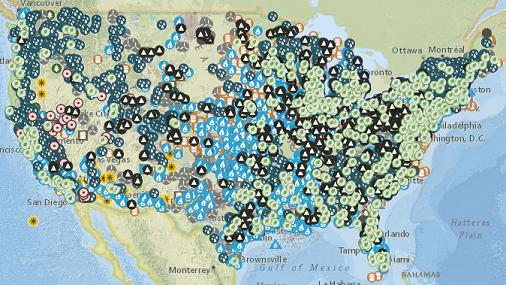
The U.S. Energy Mapping System, brought to you by the U.S. Energy Information Administration, displays customizable maps of the U.S. energy infrastructure, including coal mines, power plants, refineries, storage, hubs, pipelines, waterborne transport, wells, fossil resources and renewable potential (wind, solar, biomass, etc.).
The U.S. Energy Information Administration (EIA) is the statistical and analytical agency within the U.S. Department of Energy. EIA collects, analyzes, and disseminates independent and impartial energy information to promote sound policymaking, efficient markets, and public understanding of energy and its interaction with the economy and the environment. EIA is the nation’s premier source of energy information and, by law, its data, analyses, and forecasts are independent of approval by any other officer or employee of the U.S. Government.
EIA conducts a comprehensive data collection program that covers the full spectrum of energy sources, end uses, and energy flows. EIA also prepares informative energy analyses, monthly short-term forecasts of energy market trends, and long-term U.S. and international energy outlooks. EIA disseminates its data, analyses, and other products primarily through its website and customer contact center.
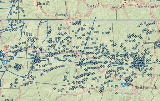
Sample map of the natural gas infrastructure centered around Bradford County, PA: