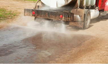
Carginogen from gas compressor stations being monitored
October 3, 2010Philly academy study finds gas drilling threatens streams
October 12, 2010High levels of ozone pollution measured in rural Uintah County last winter have federal officials and others concerned about a growing public health risk.
In order to improve air quality tighter regulatory controls may be brought to bear on the oil-and-gas industry, already hit hard by economic slowdown.
“Elevated ozone levels in the range of 103 to 123 ppb (parts per billion) were measured in the county over three winter months,” said Leonard Herr, Bureau of Land Management air resources specialist.
The measurements rival levels found in downtown Los Angeles, and are nearly double those considered permissible for healthy air standards.
“These levels are as high as any urban area in the country,” Herr said.
Perhaps the Catch 22 is the Utah Division of Air Quality and Air Quality Board do not have air quality guidelines specific to the industry.
“We do have an Oil and Gas Air Quality Partnership to evaluate the impacts and to determine the best approaches for managing the air shed,” said Amanda Smith, executive director of the state DEQ.
Yet without a standardized protocol, none of the data collected last winter meets EPA regulatory standards.
Earlier this year, the Environmental Protection Agency lowered permissible ozone levels from 80 to 75 ppb for healthy air quality over an eight-hour period. The EPA is considering lowering it further, which would make it even tougher to meet the standard.
The revision, mandated by the Clean Air Act, attributes prolonged exposure to higher-than-normal ozone levels to health hazards ranging from breathing problems to cardiopulmonary distress.
Ground-level ozone as determined by the National Ambient Air Quality Standards occurs naturally when sunlight reacts to air containing volatile organic compounds and nitrogen oxides.
In rural areas like the Basin, these ozone-forming compounds are “primarily from fumes produced in the oil and gas fields,” Herr said. More study is needed before officials can say that with certainty, he said.
Similar levels of ozone concentration were found in the Upper Green River Basin in Wyoming near the Jonah-Pinedale Anticline natural gas field. The declining air quality in southwest Wyoming could bring federal sanctions, Herr said, adding, “which is what we are trying to avoid here.”
How did we get here?
Herr recently released the findings to 60 representatives from state, local, federal and tribal governments, the oil-and-gas industry and technical experts at the first-ever Air Quality Strategy and Planning Meeting held at Uintah Basin Applied Technology College in Vernal.
The pressing nature of the session underlined the public health concern that high levels of ozone and other airborne pollutants raise for residents of northeastern Utah.
“How we got here is basically through the land management process,” said Bill Stringer, BLM Vernal district manager. He told the group that while air quality was reviewed for regulatory compliance in the past, the methods used were “archaic models” that predated the oil and gas boom.
“We sat down with industry in early 2006 and the industry agreed we needed to do something about a growing problem,” Stringer said. However, those discussions occurred before recent high-ozone measurements in the field.
In 2007, state-operated monitors on the west and east sides of Vernal measured significant ozone levels associated with wintertime vehicle traffic attributed to the boom. Air quality was presumed to improve as drilling and vehicle traffic declined when the boom ended in late 2008 and early 2009.
“Right now, we’ve got about 25,000 wells under National Environmental Protection Act review in the Vernal BLM office,” Stringer reported. Only a fraction of those wells may ever be drilled. Prior to 2000 there were perhaps 5,000 wells drilled in 50 years of oil and gas exploration in the Basin.
“From 2000 to 2008, another 5,000 wells were drilled,” Stringer said. “We’re now drilling much quicker than before.” That’s how industry simply outpaced land management processes.
“Air-quality evaluation is the next big challenge,” said Mike Stiewig, Vernal BLM field office manager. “Our goal is not to make (compliance) slower or more difficult, but to assure we adequately analyze all the impacts.”
Where are we now?
Exceeding NAAQ standards for ozone, and failure of compliance, are not a done deal, say Uintah County officials. Aggressive self regulation may involve proactive, voluntarily measures that integrate industry and agency efforts before the three-year assessment period ends.
“The industry needs to keep moving. We have a three-year period in which to return air quality,” said Duane Zavadil of Bill Barrett Corp. BBC’s recently completed environmental impact statement proposes to drill over 600 natural gas wells.
Industry advocates say the issue of air quality should not be used to shut down the oil-and-gas industry. Regulatory uncertainty looms like a sword of Damocles over industry’s head in the Basin.
“What other emission sources have been identified in this region?” said Zavadil, who requested the EPA and BLM develop an adaptive management strategy. This would require applying and developing technology to monitor and model the dispersion of ozone pollutants created in winter months.
A team from the Energy Dynamics Lab at Utah State University, in conjunction with the Idaho National Laboratory led by Marc Mansfield, a physical chemist and computer model expert, offered insight.
“Our capabilities in computer-generated models will map regionally where we have holes in monitoring and meteorological data,” Mansfield said.
Computer modeling may well determine if there is a “target on the back of the oil-and-gas industry,” as Kathleen Sgamma of the Western Energy Alliance submits, or whether other contributors need to step up.
Source apportionment studies, for example, may identify ozone as derived from vehicle exhaust, the power plant, wood stoves, the oilfield, or the air shed in general. Locating the sources of reactive gases could go a long way in determining measures for mitigation before federal regulations are imposed.
Industry representatives requested that a work plan be adopted with an executable window, perhaps in three-month periods for monitoring for source apportionment.
What are the impacts?
The collection of baseline data in the Basin has just begun. Given that rural ozone levels were only recently identified, their precise effect on people and ecosystems in the Basin have not yet been determined.
Air-quality conditions are monitored, primarily for PM2.5 particulates that come from wood-burning stove soot and ambient dust, at many locations along the Wasatch Front.
There are two industry-operated monitors at Ouray and Red Wash, two tribal monitors at Myton and Whiterocks, and one operated by the National Park Service at Dinosaur National Monument.
More monitors are needed, said Herr, in order “to improve … on-the-ground validation to assess the future of the industry.” The Ouray and Red Wash monitors are run by subcontractors and are not approved by the agency.
“Last winter’s ozone numbers don’t bode well for becoming compliant in three years,” said Herr.
Effects of ozone-forming pollutants would have to be monitored over three-month periods under a formal assessment by the EPA to potentially designate an area as failing to meet air quality standards.
Daly and Herr stress that the process needs to collect data with as many stakeholders in as broad an area of the Basin as possible. The Air Quality Strategy and Planning Group includes members of industry, government and research.